
Ever wondered how Mapbox helps Cargo Signal deliver real-time shipment data to our customers? Our unique partnership gives shippers the ability to actively monitor the location and security of their freight. 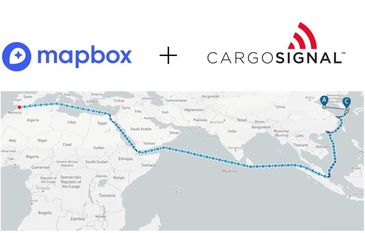
Did you know that Mapbox is an essential tool that helps Cargo Signal keep their customers’ shipments safe and on time?
The IoT-powered sensors that Cargo Signal attaches to global freight track real-time data about shipments, providing end-to-end visibility, security, and quality control. But how does that real-time data get translated into real-time visibility Cargo Signal customers can easily identify and interact with? How does real-time visibility become real?
That’s where Mapbox comes in.
Without the right platform, data stays just that: data. Using highly sophisticated location intelligence technology, Mapbox provides the platform that brings Cargo Signal’s data to life as a dot on the map. This unprecedented collaboration of rich data sets and optimized visualization allows customers to view the exact location of their shipments in real time and delivers that information on a familiar and user-friendly interface.
That’s a great asset to customers who rely on shipments getting where they need to be safe and on time. When you can see the exact location of your shipment, and you know what state, city, highway, neighborhood, intersection, or even street it’s on, at any given time, you can anticipate disruptive events and prevent minor problems from spiraling into major problems. You can troubleshoot in the moment and even intervene during emergencies.
Thanks to Mapbox, if a thief tries to make away with a truck full of expensive product, we don’t just know it’s happening, we see it happening–in real time and on the map, easily allowing us to put a stop to it.
Here’s what happens: If a truck falls vulnerable to theft and diverges from its predetermined route, our sensors send us an alert about the suspicious activity. Then our Command Center, staffed by logistics professionals who monitor shipments around the clock, 365 days a year, alerts the local authorities, using the map to track the truck’s progress. Thanks to the Mapbox visual interface, Command Center maintains full visibility as the situation progresses. They work closely with law enforcement every step of the way to keep them informed with up-to-the-minute information. Command Center also tells law enforcement officers where the perpetrator is and what direction they’re heading, effectively mitigating the situation and preventing the robbery.
But Mapbox helps Cargo Signal’s customers prevent more than just outright theft. Thanks to Mapbox overlay features, customers can view real-time traffic, weather, and regional temperatures. These features are invaluable for their ability to foresee impending threats to cargo and prevent external forces from spelling catastrophe.
What if a pallet of temperature-sensitive, potentially life-saving medication is waiting for pickup outside on the tarmac and an unexpected heatwave or blizzard is on the way? Cargo Signal is able to see the incoming threat on the map and take action before it’s too late. The warehouse manager is then contacted, the pharmaceuticals are stowed away safely, and then rush-shipped once the weather turns, preventing spoilage and ensuring safe delivery to the community in need.
Mapbox empowers Cargo Signal customers to prepare for the unpredictable, keeping freight in sight, secure, and on time.